

GIS Blog
My aim is to provide you with valuable resources and tutorials on Geographic Information System (GIS) technology, with a focus on open source software.
Whether you're a seasoned GIS analyst or a student just starting in this field, our blog will offer insights and knowledge to enhance your GIS skills.
The blog contains a range of articles, tips, and tricks, covering various aspects of GIS technology, including data acquisition, analysis, visualization, and dissemination.
I'll also share my insights on the latest trends and innovations in GIS, and how you can leverage them for your projects.
I believe that GIS software should be accessible to everyone, and I am dedicated to sharing my knowledge and expertise with you.
Whether you're looking for resources to advance your GIS skills or seeking inspiration for your next project, GISAnalyst.net's blog section has got you covered. Feel free to share your thoughts and feedback with me.
Latest Posts:

What Coordinate System Should I Use?
Maps are incredibly helpful for finding your way and understanding the world around us, but did you know that there are different ways to show locations on a map? That’s where coordinate systems come in! Learn about the importance of coordinate systems in mapping and how to choose the right one for your project.
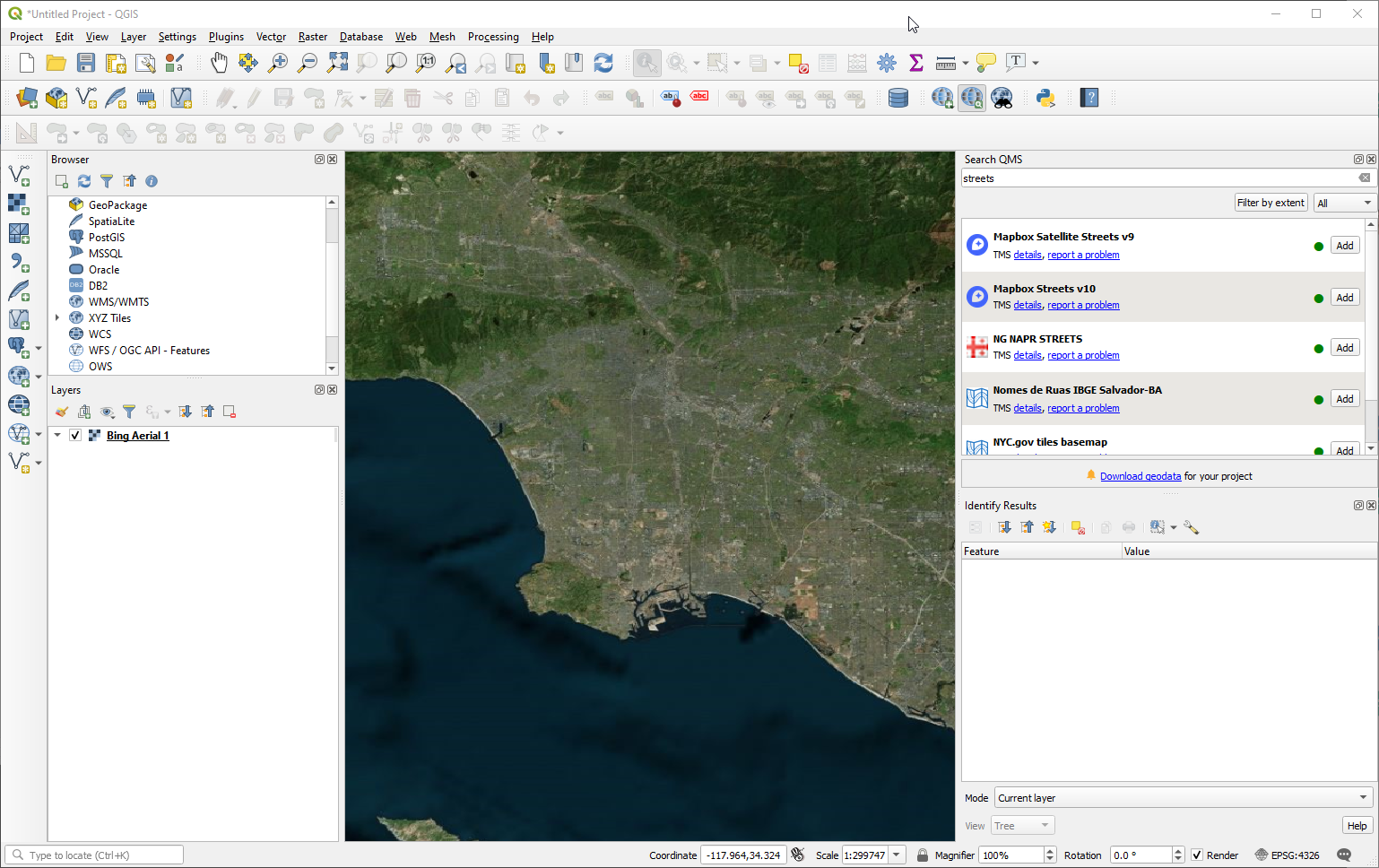
How to Add a Basemap to QGIS
A basemap is an essential component of a good map as it provides geographical context to the other layers in the map. While QGIS does not come with built-in basemaps, there are several plugins available that can be used to add basemaps to your project. In this post, we will discuss how to add a basemap to QGIS using the Quick Map Services plugin. We'll also walk you through the process of installing the plugin, adding basemaps using Quick Map Services, and searching for specific basemaps. By the end of this post, you should be able to add a basemap to your QGIS project quickly and easily.

Free Desktop GIS Software List
Looking for free and open source desktop GIS software for your geospatial data analysis and visualization needs? Check out our list of the top 6 software programs including QGIS, GRASS, SAGA GIS, gvSIG, uDig, and Whitebox GAT.

The Power of QGIS as Free and Open Source Software
QGIS is an increasingly popular GIS software application that offers a range of features and tools for data management, analysis, and web mapping. As a FOSS application, QGIS can be modified to perform different or more specialized tasks, making it a versatile and adaptable tool for GIS professionals, researchers, and enthusiasts. This article explores how the FOSS model of QGIS has led to the development of specialized applications like QGIS Browser and QGIS Server and the benefits of an active community of developers and users who work together to improve the software and create new plugins and tools.

Using Print Layout Function in QGIS to Create Maps
In this beginner tutorial, we will guide you through the process of using the Print Layout function in QGIS to create a map. The Print Layout function is a powerful tool that allows users to prepare print maps with multiple map views, labels, legends, and other elements. Whether you are a researcher, government agency, or business, being able to create maps tailored to your specific needs is essential. This tutorial provides clear and concise instructions, along with screenshots, to help you understand each step of the process. By the end of this tutorial, you will be able to create a map using the Print Layout function in QGIS.